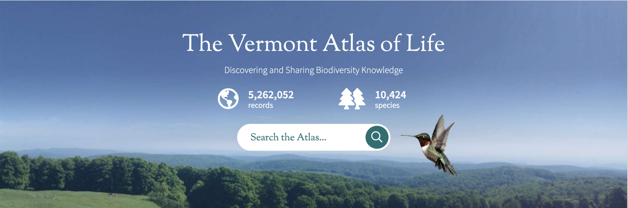
Big Biodiversity Data Now at Your Fingertips
The Vermont Center for Ecostudies launched an ambitious online project that allows anyone to explore vast amounts of data on biodiversity across the Green Mountain State. Now released as a beta version, the Vermont Atlas of Life Data Explorer is the newest implementation of the Living Atlas platform, powerful software first developed in Australia and now being implemented by countries around the globe.
The VAL Data Explorer offers users – free of charge – a way to explore over 5.5 million records of plants, animals, and fungi found in Vermont. Accessing an ever-growing statewide biodiversity database, the VAL Data Explorer is a collaborative, open, digital platform that combines Vermont biodiversity data from multiple sources, making it accessible and reusable. VAL’s digital platform supports: access to species information, data downloads, online mapping and analysis tools, data collection, upload, aggregation and sharing, and more.
“As our activity profoundly alters the map of life on local and global scales, our response requires knowledge of plant and animal distributions across vast landscapes and over long periods of time,” said Kent McFarland, a conservation biologist at the Vermont Center for Ecostudies and project leader. “The VAL Data Explorer is a tool that brings us closer to that understanding.”
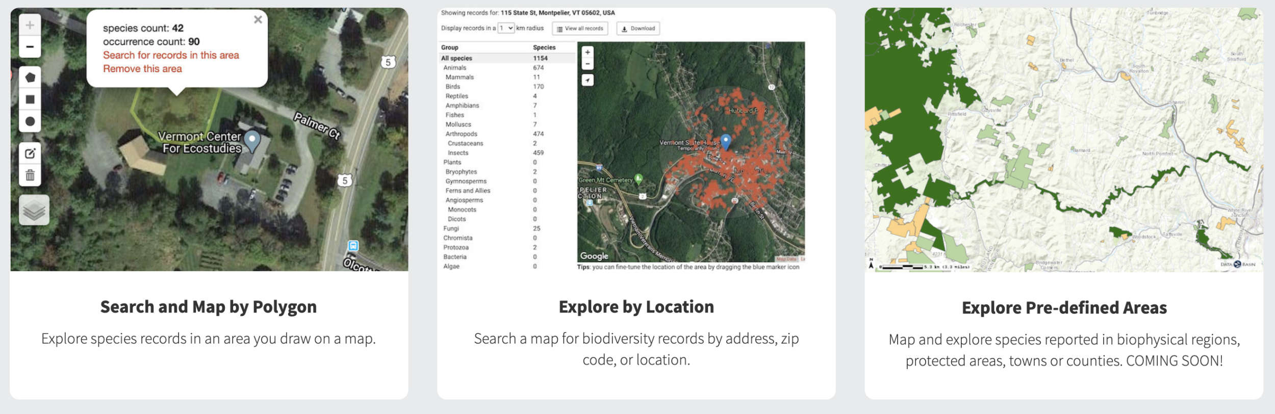
With the Vermont Atlas of Life Data Explorer, users can explore biodiversity records on maps using addresses and locations, search by drawing a polygon, explore predefined areas such as biophysical regions or wildlife management areas, or search for a species or group.
Vermonters have long upheld a tradition of documenting biodiversity. Biologists and volunteers have recently completed major statewide atlases of birds, butterflies, reptiles, and amphibians, and new biodiversity information is added every day via Vermont eBird and the Vermont Atlas of Life on iNaturalist. Yet these efforts represent a fraction of the state’s biodiversity data. The VAL Data Explorer bridges critical gaps in the loose network of individuals, scientists, organizations, and governments collecting biodiversity knowledge here in Vermont and across the planet.
VAL also links Vermont to worldwide biodiversity projects. The Vermont Atlas of Life has been an official Global Biodiversity Information Infrastructure (GBIF) biodiversity data publisher since 2018. GBIF is an international network and research infrastructure funded by the world’s governments, providing anyone, anywhere, open access to data about all types of life on Earth. The GBIF network includes hundreds of institutions that publish biodiversity data, like the Vermont Atlas of Life.
Coordinated through its Secretariat in Copenhagen, the GBIF network of participating countries and organizations, working through participant nodes, provides data-holding institutions around the world with common standards and open-source tools that enable them to share information about where and when species have been recorded. This knowledge derives from many sources, including everything from museum specimens collected in the 18th and 19th centuries to geotagged smartphone photos shared by amateur naturalists in recent days and weeks.
The GBIF network draws all these sources together through the use of data standards, such as Darwin Core, which forms the basis for the bulk of GBIF’s index of hundreds of millions of species occurrence records. Publishers like VAL provide open access to their datasets using machine-readable Creative Commons license designations, allowing scientists, researchers and others to apply the data in hundreds of peer-reviewed publications and policy papers each year. Many of these analyses—which cover topics from the impacts of climate change and the spread of invasive and alien pests to priorities for conservation and protected areas, food security and human health— would not be possible without this.
Data sharing has become an important issue in modern biodiversity research to address large scale questions and conserve species. Despite the steadily growing scientific and conservation demand, data are not always easily accessed. Worse, it may be lost forever if it is not properly archived. Data found at VAL and GBIF are provided by a wide range of cooperating organizations, websites, individuals, community groups, community scientists, government agencies and others. VAL works closely with data providers to assist them to better capture, manage, and share biodiversity data.
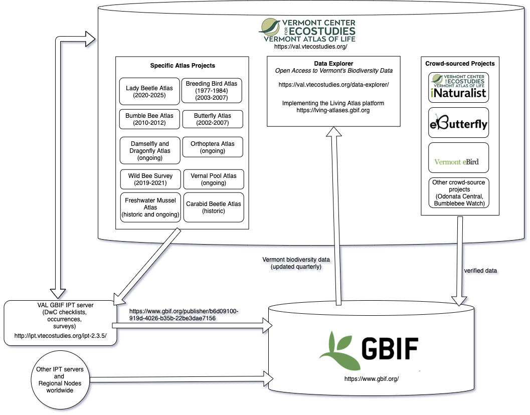
A simplified diagram of how biodiversity data is captured and mobilized for the Vermont Atlas of Life Data Explorer.
Perhaps you have a dataset of species observations that are only on paper forms. Or maybe you have an old spreadsheet or database from work you completed long ago that is somewhere on your computer. Maybe you have notebooks filled with field sightings. Whatever the situation, your hard work will be more widely used for science, conservation and education if others can access it now and far into the future. Whether you want to create a specific atlas on our site, share data with others, or just archive your data for the future with restrictions – we’re here to help you find a solution that fits.
The Vermont Atlas of Life is a member of the Living Atlases, an open community created around the Atlas of Living Australia (ALA) platform, a key software component of GBIF. Jason Loomis, VAL project software developer, works closely with the Living Atlas community to implement the software and mobilize data.
“There’s a team of developers, centered mostly in Australia but also around the globe, that are continuously evolving the Living Atlas software, which comprises many interlinked databases and toolsets based entirely on free and open-source software,” said Jason.
As more atlas nodes have joined around the world, the community has added technical and support resources to assist new nodes and to enable its architects and developers to continue to improve the core software products.
“The software and data mobilization is fairly complex, but it works remarkably well. The community’s evolution has nicely kept pace with the needs of its members. We couldn’t have implemented it without such a gracious community of people helping us along the way,” said Jason.
From its inception, the Vermont Center for Ecostudies has been a leader in identifying and mapping Vermont’s biodiversity. Enlisting a legion of community scientists to support our efforts, VCE has managed groundbreaking atlas projects on breeding birds, butterflies, bumblebees, vernal pools and more. The Vermont Atlas of Life includes these and millions of other biodiversity records, becoming a legacy for Vermonters. The result will enhance life in the state by supporting scientists, taxonomists, natural resource managers, land-use planners, policy makers, elected officials, community-based groups, teachers and students, and anyone with even a passing interest in the nature of Vermont.
Watch this short overview by the Living Atlas community to learn more about how the platform functions.
Nice work, Kent. So proud of you!