How We’re Taking Species Mapping to the Next Level
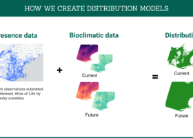
Using Species Distribution Models based on observations submitted to the Vermont Atlas of Life by community scientists, in combination with environmental data collected by satellites, can help land stewards create habitat conservation and restoration plans.
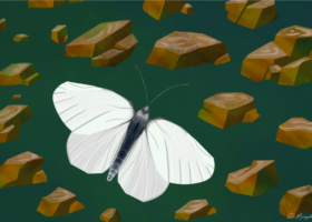
Searching for Butterflies: The West Virginia White
As VCE’s Spatial Science Intern, I spent my summer working with community science observations from several platforms, such as eButterfly and iNaturalist, to create a species distribution model for the West Virginia White in the state. This model incorporated bioclimatic variables and host-plant distributions to reveal areas within Vermont that may be suitable for these butterflies today and into the future.