The Invisible Boundaries of Sierra de Bahoruco National Park
This piece is an English translation of a story written by Marvin del Cid and published on 25 March 2015 at DiarioLibre.com. Marvin — an award-winning photographer, visual arts expert and journalist — is currently a staff writer for Diario Libre, the Dominican Republic’s leading newspaper. He holds a degree in communications and is an expert in digital/multimedia technologies. Originally from Guatemala, Marvin has lived in the Dominican Republic since 2003 and donates his talents to many worthy causes. He closely follows conservation issues in Sierra de Bahoruco and elsewhere. For more about Marvin and his work, visit http://www.marvindelcid.com. See Marvin’s original story (in Spanish) at http://www.diariolibre.com/noticias/2015/03/25/i1069421_los-lmites-invisibles-del-parque-nacional-sierra-bahoruco.html. Please note that VCE accepts responsibility for any errors of translation. We and our many conservation partners are committed to improving the conservation outlook for Sierra de Bahoruco, where VCE has worked since 1994.
Pedernales, Dominican Republic- Just over two years ago, Diario Libre published a story on the deforestation in the área of El Aceitillar at the base of Sierra de Bahoruco. In this spot, this park is adjacent to Jaragua National Park.
Readily noticeable was lack of control from the authorities in halting illegal agriculture, which has for years affected this part of the Jaragua-Bahoruco-Enriquillo Biosphere Reserve. Just a few meters from the ranger station at the Park’s entrance, plantings of pumpkin, beans, corn, etc. were more than evident.
Less than a year ago, Diario Libre again published a long piece on charcoal making and trading in Sierra de Bahoruco’s northern slopes. Then, we documented the deforestation that results from those practices.
This time, we used the latest technology to visit the southern slopes: a new generation drone that gave us impressive views, a bird’s-eye view of the same sites we visited on foot two years ago.
El Aceitillar
After our earlier denunciations, we expected to see some progress in controlling deforestation in the area and to note some kind of natural vegetation regeneration.
On an iPad, we could see the images sent by the drone in real time, and they were anything but good.
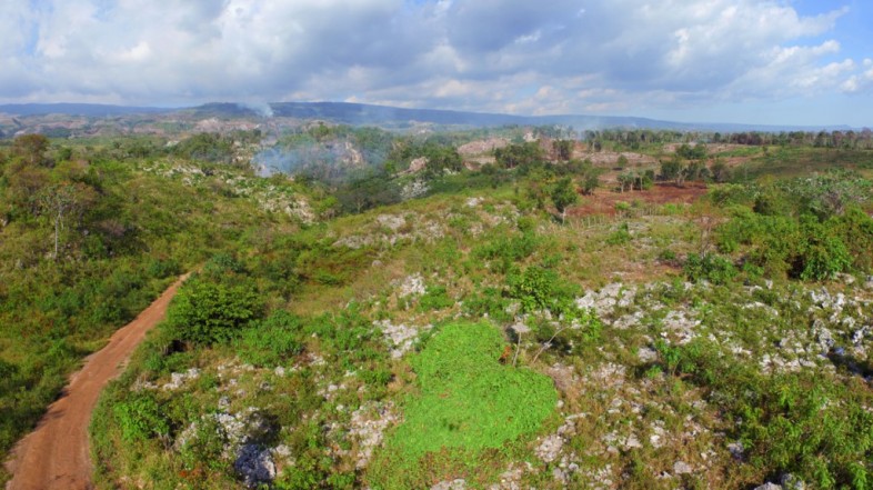
This 360 degree image shows the deforested area near El Aceitillar road.
A 360 degree panorama created from a drone showing deforestation in Sierra de Bahoruco National Park. Click on the image to visit a full panorama.
We launched the drone east of the bauxite mine, just where the two parks meet, and the destruction from previous years was evident, as well as how it has continued to advance. What was once a dry forest is now mostly rocks and small islands of vegetation.
“Every Dominican citizen should visit Sierra de Bahoruco. Its importance needs to be lived and not explained. Only then will we be able to defend it.”
Mario Dávalos, advertising expert and nature photographer“Sierra de Bahoruco, because of its isolation from the capital, has never been a priority for authorities, and the day they wake up, it will be too late. For me, it is a sort of (Jesus) Christ: sold, pillaged, burned down, mistreated, and turned to charcoal. Still, she comes back to life as the Phoenix out of its ashes to freely yield to us her endemic, hidden treasures in the heart of this legacy of our island.
Dr. José M. Pantaleón, physician and nature photographer
Among houses, trucks and fences, we spoke with a group of Haitian farmers who told us that as soon as the rains start, they will begin planting beans and corn for their Dominican boss. “We give him four sacks of harvest from every five we produce,” they told us.
We could see several columns of smoke in the distance; they didn’t look like forest fires, but more like very localized fires to prepare fields for the planting season.
El Mogote
A few kilometers northeast of the village of Las Mercedes, where the Ministry of the Environment issued an irregular permit last October to deforest a parcel inside Jaragua National Park, we reached an area called El Mogote. This area is located just inside the boundary of Sierra de Bahoruco National Park.
We were able to see smoke columns to the north and east, verified them on the GPS, and they were inside the park.
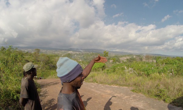
With the drone in the air, a group of farmers appeared, attracted by the noise of the flying machine. We talked with them a few minutes; when we asked them what they’re up to, they tell us they are burning some areas to clearcut the trees and to prepare the land for planting before the rains come.
Without hesitation, the farmer mentions the “owners” of the land and how they must pay them four sacks out of every five they harvest.
We can see on the iPad the deforestation from the drone’s-eye view. Below, by comparison to the navigation map of 2012, there is a marked reduction in vegetation cover.
Los Arroyos
The next day we climbed to the highlands in the park’s southwest corner, known as Los Arroyos. At that moment, a 160-man brigade of the Ministry of the Environment was finishing off the control of four fires in the pine forest, six kilometers to the east, an area that can only reached by mules or on foot.
Here the park is different: the dry forest remains below, and humid forest emerges where the clouds meet the Sierra. This is where most of the park’s biodiversity is concentrated — its endemic flora and fauna — and where most migratory birds take refuge, since before humankind ever set foot on the island. A little further up the road, the humid cloud forest gives way to lush Hispaniolan pine forests.
Los Arroyos is in a sort of limbo; no one is clear where the park boundary is. We are not sure where the border lies; there is no physical delimitation. Again, we have to bring out our GPS to know if we are inside or outside.
“It hurts to see how the indifference of authorities aggravates the troubles affecting the park due to its borderland condition. It’s urgent that the park’s boundaries are marked and respected.”Pedro Genaro, photographer and conservationist
“The forests of Sierra de Bahoruco can’t wait much longer; they require firm and immediate actions seeking to solve the problem over the long term.” Eladio Fernández, photographer and conservationist
Such is the disorientation that there’s a worn-out sign with letters missing that reads: “Welcome to Parque Nacional Sierra de Bahoruco”; this should mark the boundary, but is actually 1.5 kilometers inside the park.
Deforestation almost touches the sign on its south side, as if saying we can cut up to here, but it then curves beyond the sign, and after a curtain of trees, avocado groves and plantations appear again, as if defying the law. It’s curious that the only word barely legible on the sign is “Welcome“.
Here we launch the drone again, as clouds have lifted. The view is chilling — the forest has been lacerated, and many areas of native vegetation have been replaced by export avocados.
“We are getting used to the idea that in 10 years there won’t be any humid forests left on Bahoruco’s southern slopes, unless there is a radical change in management of this park.” Yolanda León, Professor and biologist.
“Sierra de Bahoruco is the reserve with most of the biological diversity on this island; it is sad to see how they are destroying it and alarming the degree of negligence of the authorities in this regard.” Héctor Vilorio, photographer and conservationist
“I feel we are losing a lung of the Dominican Republic, by losing Sierra de Bahoruco, invaded today by both Dominicans and Haitians based on double illegality. The indiscriminate felling of trees and expanding agriculture are baring the bones of Bahoruco’s terrain. All this is of little concern to the Dominican State.”
Nicolás Corona, nature guide and field biologist
This history repeats itself; farmers mention by name their patrons, who ignore that they are inside a protected area.
A park that is not unequivocally delimited, powerful landlords claiming land as their own, immigrants working for a few sacks of beans — everything is the same as we left it two years ago.
At the highest point of the Sierra, on Loma del Toro, on the forest road that used to be a site for trafficking stolen vehicles, and where only the GPS tells us which country we are in, the remains of charcoal kilns remind us what we’ve just witnessed and continues to take place.
Download a Google Earth KML file of the official national park boundaries (7.7 MB)




Hace cinco anos visite la Sierra de Bahoruco con amigos Dominicanos, entre estos Jose Pantaleon. Eel problema de deforestacion es muy serio y complicado, ya que involucra a Haitianos y Dominicanos. Detener o controlar este problema va a requerir traer a una misma mesa las partes involucradas y negociar acuerdos que puedan ser verificados, darle seguimiento y constatar progreso de la situacion.
Every body knows there is an invasion of private and public properties by our neighbors who are causing massive deforestation at a criminal level , selling charcoal to the neighboring country, illegally cultivating lands under the excuse that they are poor and need to survive.
I believe Deforestation is a crime against humanity because it affects all citizens of our planet and laws should be implemented to severely punish those who commit these crimes.