Using Both Old and New Technology to Monitor Forests
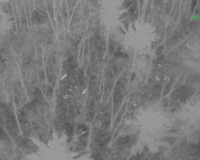
Two deer caught on the thermal camera on the Dome in the Green Mountain National Forest
When VCE first partnered with Raritan Valley Community College to monitor forest response to prescribed burning in the Green Mountain National Forest, we had some basic questions to address—what data do we want to collect and how will we collect it?
Methodology is an important step in project design, and will dictate what you can learn from your monitoring efforts. We decided to model our sampling after the US Forest Service Forest Inventory Analysis (FIA), which is built for long-term monitoring. By incorporating these methods, we ensure that the data we collect will be comparable to data previously collected as well as most future monitoring. We then gave some thought to additional variables like deer density, invasive species, and plants known to support rare insects. This kind of information can tell a more complete story about how the forest is responding to disturbance, in addition to what we know about the tree species. The result of this approach was a combination of both low and high-tech methods to better understand how the dry oak systems of the Green Mountains respond to prescribed burning.
From hand tools to high-powered tech, we took a close look at every level of the forest. An assortment of hand tools such as DBH tape and meter sticks helped us to record duff and litter depth, percent ground cover, forest structure, species richness and diversity, stand age class, coarse and fine woody debris, and regeneration in the study sites. All of these variables can help tell the story of a forest, and what kind of regeneration we can expect in the future. This data also allows us to compare the response of the burned forest to unburned plots. To expand our data collection, we went beyond the traditional forestry tools mentioned above and brought in ground-based LiDAR and drones to round out our field work.
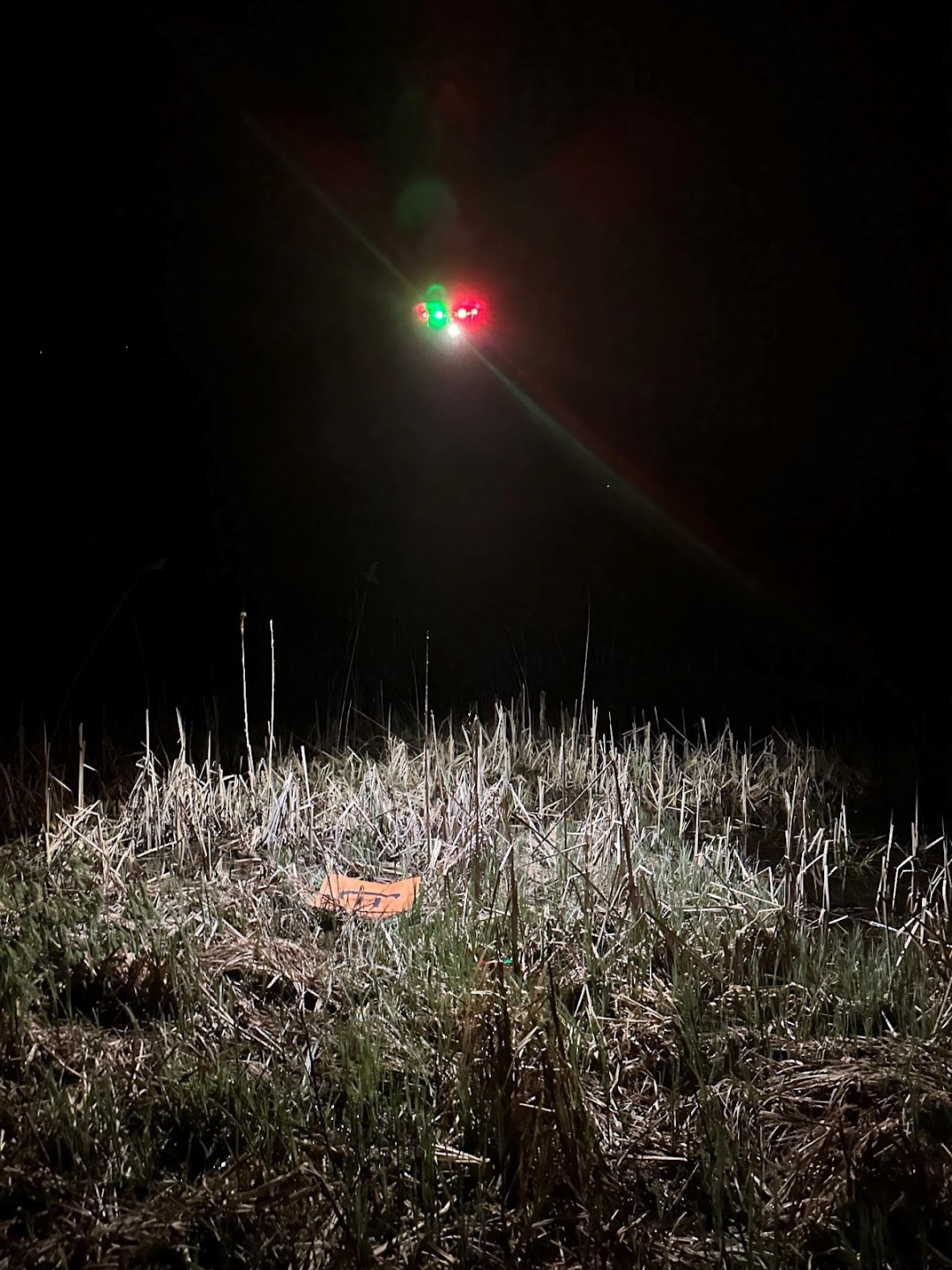
Drone takes flight to survey deer density in the Nature Conservancy’s Great Ledge Preserve
Using a Leica BLK360 scanner, we were able to generate high-precision laser scans of the forest and identify differences among sites, and site changes over time, with greater detail than ever. This detailed scanning is essential because it focuses on the understory structure of the forest, an area that will become the next cohort of canopy trees. Similarly, using an Autel EVO II Dual drone outfitted with a FLIR 640 Thermal Sensor, we were able to conduct nocturnal deer surveys with a greater confidence in our density estimate than scat surveys or spotlighting would produce. Deer densities and signs of herbivory in the understory are key variables in this monitoring because elevated levels of herbivory can significantly reduce tree regeneration in oak forests and can have serious impacts to expected management outcomes.
We will report back later this year on our initial findings on if and how using prescribed burns as a management tool influences forest structure and regeneration in dry oak forests.