Surveying Potential Vermont Breeding areas
 We have conducted intensive surveys for the past four breeding seasons in different regions of Vermont. These surveys are a first step toward determining where additional effort may be focused and providing more thorough population estimates for the state.
Reports
- Survey Report 2014
- Survey Report 2015
- Survey Report 2016
- Survey Report 2017
- Survey Report 2018
- Survey Report 2019
- Survey Report 2020
The ANNUAL Northeast Nightjar Survey
The Eastern Whip-poor-will (and other nightjars) have been declining throughout their range in eastern North America for at least several decades. This decline is borne out by the limited data available from the Breeding Bird Survey (BBS), numerous anecdotal accounts, and most recently by data collected in five second-round state Breeding Bird Atlases. These latter suggest that the number of atlas blocks occupied by the species has declined by roughly 50% in the last twenty years in the following states or provinces: Ontario, New York, Vermont, Pennsylvania, and Maryland.
While it is clear that the species is declining, there are limited data with which to access the magnitude of the change. BBS data are limited because the number of detections is quite small and atlas data provide only distributional limits. The Northeast Nightjar Survey was conceived as a means to obtain more robust population trend data across the Eastern Whip-poor-will breeding range in the northeastern United States, and ideally other areas where nightjar populations are in need of monitoring. The first Eastern Whip-poor-will surveys in New Hampshire were implemented in the Piscataquog River Watershed in 2003, and in following years the project expanded to include most of the state. In 2005 it expanded further to include surveys in Vermont, Massachusetts, and Connecticut. It expanded to Maine, New York, New Jersey, and Maryland in 2006, and into Wisconsin and North Carolina in 2007. During this period of expansion, the protocol was refined several times, most notably to incorporate the documented variation in calling rate with lunar conditions. It was also determined that randomly placed routes would not be an effective way to monitor the species over most of the Northeast.
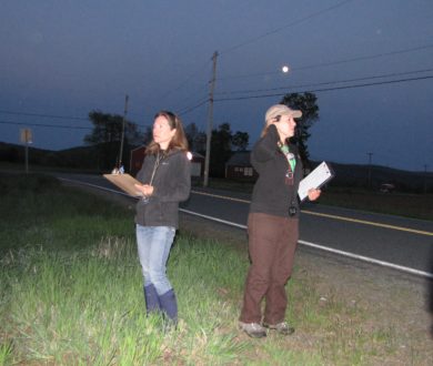
The final protocol developed in 2007, and used subsequently, consists of a series of ten point counts spaced at one-mile intervals along roadways. At each point, the observer records whether individual nightjars were detected in each of six one-minute periods, resulting in a new line of data for each bird heard. All surveys are completed during periods of high lunar illumination, defined as the moon at least half full, not obscured by clouds, and completely above the horizon. Observers also recorded data on weather (cloud cover, wind) and noise levels (categorical scale, number of cars). In some cases two observers independently recorded data simultaneously, and several routes were also repeated twice within the season.
With the help of citizen scientists, each year VCE conducts a statewide, annual EWPW survey on 17 routes throughout Vermont. The survey helps us to detect dramatic changes in the Vermont population and contributes to broader efforts to detect regional changes in the northeastern population.
