Hiking Boots on the Ground: Verifying Our Computer-Generated Habitat Predictions
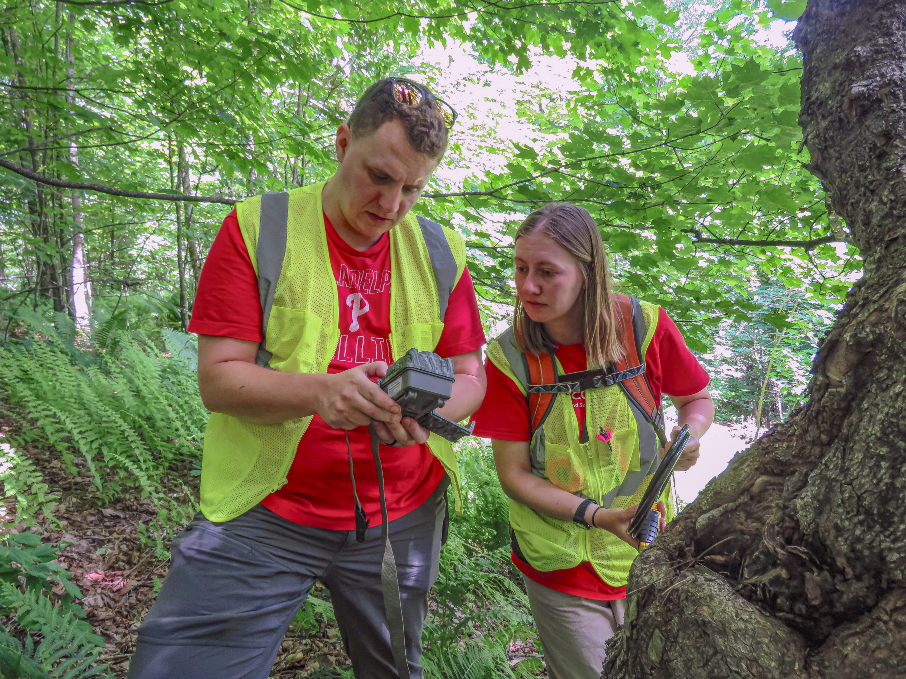
Brian Kron and Colleen Clausen find one of their trail cameras i n Allis State Park, Brookfield, Vermont. © Fiona MacLean
“It’s gotta be around here somewhere,” I mutter to myself as I wade through the dense brush in a remote area of Allis State Park in Brookfield, Vermont. Nearby, Ground-Truthing Technician Colleen Clausen shuffles through the waist-high herbaceous plants. We are immersed in stifling heat and humidity and surrounded by downed trees and branches. The forest floor has been completely taken over by dense growth since April, when we placed a trail camera and two autonomous recording units (ARUs) on the trees.
We’re traipsing through the forest to do what many scientists call “ground-truthing,” a fancy way of saying we need to confirm on the ground that what we’ve predicted on our computers is true. For almost two years, I’ve been working as a postdoctoral researcher with VCE Data Scientist Mike Hallworth and the Vermont Fish & Wildlife Department to map species distributions. The goal is to improve conservation and enhance Vermont Conservation Design, a project that identifies ecologically important areas across the state for conservation.
Our species distribution models combine multiple layers of data to identify areas that might have suitable habitat for different species. (You can read more about species distribution models and how we use them in an article I wrote for Field Notes last fall.) Last year, we secured a competitive grant from the Northeastern States Research Cooperative to ground-truth our distribution maps for 118 species. We’re hoping not only to find out how accurately our models predict the presence of a species, but also to collect as much data as possible about the other species that inhabit these 40 locations. I, for one, was hoping to finally see a moose in person.
At remote locations across the Northern Piedmont and Northeastern Highlands regions of Vermont, we had set up a mini biodiversity monitoring station that consisted of a motion-detecting trail camera to capture mammals and birds, an acoustic recording unit that listened for bird songs and frog calls, and another recording unit tuned to detect the ultrasonic frequencies of bats. Now it’s mid-June, and after two months of continuous recording, it’s time to take them all down, and we have 39 more sites like this to visit.
With these locations up to 125 miles from the VCE office, this is just the beginning of three weeks and roughly 2,000 miles of travel to collect our equipment and find out just what kind of species Vermont’s northeastern habitats are harboring. These three weeks will be spent alternating between the roaring of the road underneath the VCE field vehicle and the peace of the forest, with its smells of flowering trees, pines, soil, and rain.
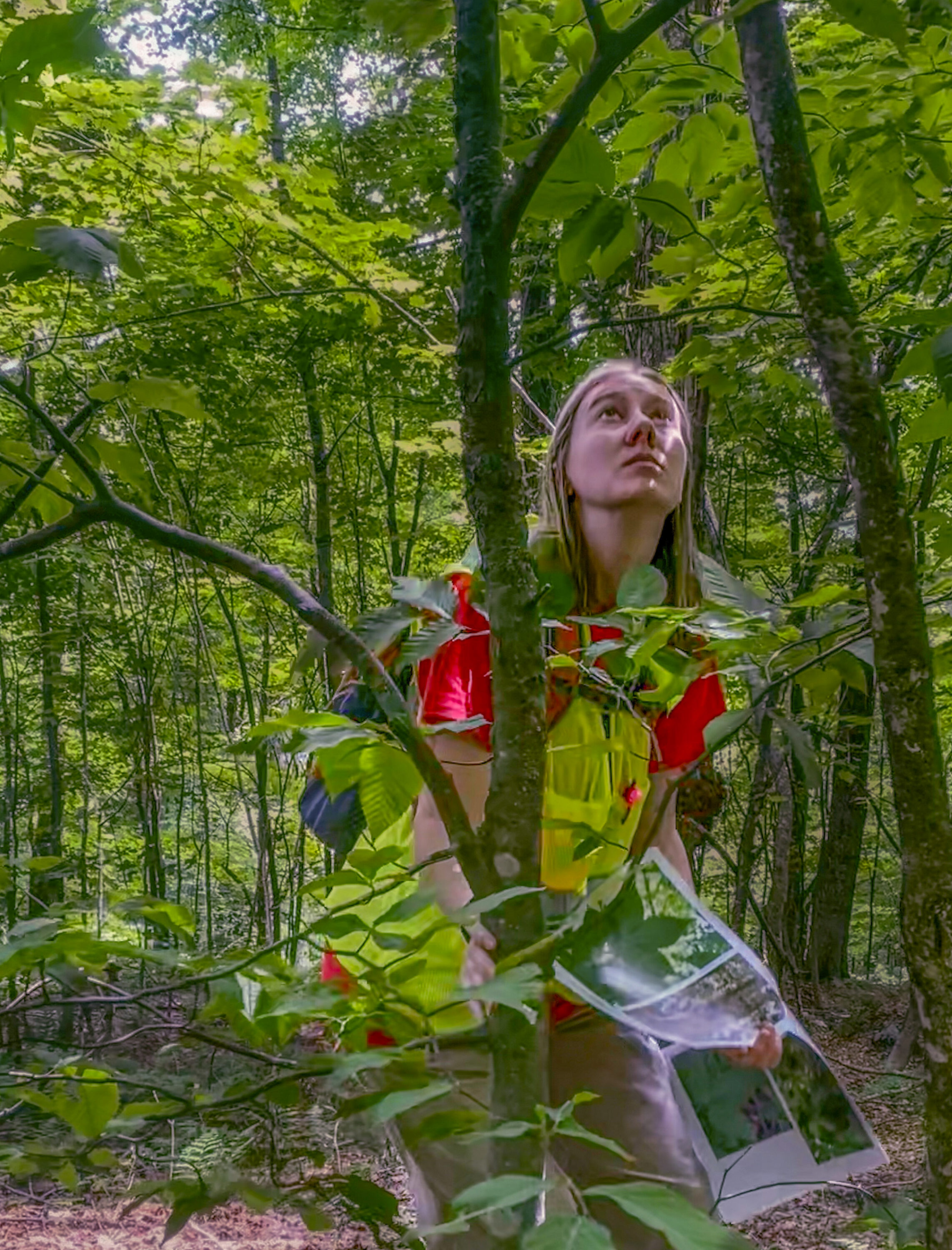
Colleen Clausen counts a beech tree during the study’s plant survey of Allis State Park, Brookfield, Vermont. @ Fiona MacLean
Suddenly, Colleen exclaims, “I found one!” It’s our frog and bird recording unit, wrapped in orange flagging tape and zip-tied to a small tree about five feet from the ground. Sure enough, one after another, we find all three pieces of equipment, and we get to work.
We start by removing our camera and ARUs. Before I turn off our camera, though, I can’t resist scrolling through some of the pictures we’ve captured. “We’ve got a bear!” I shout to Colleen. It’s an exciting find for this suburban Philadelphia kid, and a welcome change of pace after a steady stream of pictures of White-tailed Deer and plants waving in the wind.
After packing up our equipment, we start a comprehensive survey of plants to finish off our inventory of the site. Colleen and I stand roughly 1.5 meters apart and walk slowly (with some scrambling over rocks and logs) while scanning the ground for plants that are on our list of target species. We then establish a 30-by-20-meter transect inside of which we measure the diameter of every tree trunk. We also estimate the coverage of ferns and other ground-cover types. These data will help us better understand the habitat features that explain the presence of the species we observe or detect.
By the end of the season, we had collected almost 51,000 images and 17,000 recordings. We’ve so far identified at least 23 bird or mammal species in our images, including deer, moose, bear, and lots of Hermit Thrush. Once we analyze our audio recordings, we’ll hopefully add plenty of frogs, birds, and bats to that list. These results will help us not only refine our models, but also provide valuable data to our conservation biologists who use these types of observations to develop stewardship strategies.
We caught at least a half dozen moose on camera, but I’m sad to say I have yet to see one in person. It might be too late—by the time you read this, I will be well into my first semester teaching biology at Walsh University in Ohio. But the team at VCE led by Hallworth will continue this project, and I’m grateful and honored to have been a part of this important work to protect Vermont’s wild fauna and flora.